
Quick answer
The snorkeling gran canaria map divides the coastline into three main zones: the calm southwest beaches around Puerto Rico and Amadores with shallow reefs, the marine reserves of Sardina del Norte and Arinaga on the north and east coasts with rocky terrain, and the protected coves of Mogán and Agaete in the west. Public beaches are free to access daily from 00:00 to 23:59, and the best conditions typically occur between 09:00 and 12:00 when water clarity peaks.
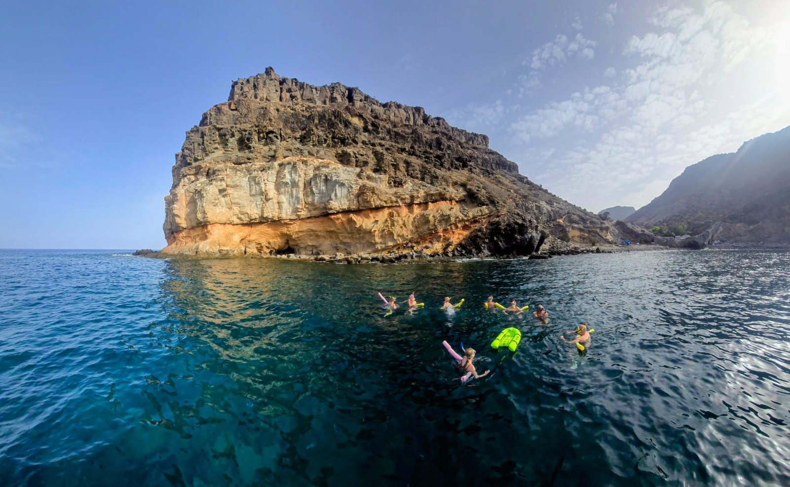
Gran Canaria sits in the path of the Canary Current, which brings nutrient-rich Atlantic water that supports over 350 fish species, making coastal mapping essential for finding productive snorkel sites. The island's volcanic origin created an underwater topography of lava shelves, caves and boulder fields that drop to different depths within meters of shore. A detailed snorkeling map of Gran Canaria reveals that the south and southwest coasts offer the most accessible entry points, with artificial breakwaters at Anfi del Mar and Patalavaca creating lagoon-like conditions year-round. The northeast Atlantic Biogeographic Region designation protects several sites where parrotfish, damselfish and trumpet fish congregate around basalt formations. Playa del Cabrón near Arinaga marks the island's premier shore-dive location, where a marked underwater trail follows a reef system at three to twelve meters depth. The northwest coast between Puerto de las Nieves and Sardina del Norte presents more exposed conditions but rewards intermediate snorkelers with sightings of rays and octopus in kelp beds anchored to lava rock. Charco Azul, a natural tidal pool near Agaete, appears on specialized coastal maps as a sheltered alternative when open-ocean swells exceed one meter. Water temperature ranges from 18°C in February to 24°C in September, which influences where thermoclines form and where marine life aggregates. Navigating between sites requires attention to road access—many prime locations sit at the end of unpaved tracks or require a fifteen-minute walk from parking areas. The GC-1 motorway connects southern resort beaches, while the GC-2 serves northern marine reserves. Local dive shops in Mogán, Puerto Rico and Arinaga provide laminated waterproof maps that mark entry and exit points, depth contours and seasonal hazards like jellyfish migration corridors. Understanding this spatial layout before you arrive lets you plan a circuit that matches ocean conditions to your experience level and transportation options.
“Gran Canaria's volcanic topography creates underwater lava shelves and boulder fields that drop to different depths within meters of shore.”
Navigating to Your Snorkeling Gran Canaria Map Locations
Most snorkeling locations on Gran Canaria are accessible via the GC-1 motorway that circles the eastern and southern coastline. For those relying on public transit, the island-wide Global bus network provides frequent connections to major coastal hubs.
Global line 01 to Puerto de Mogán
GC-1 motorway to Maspalomas
GC-1 motorway from Las Palmas
Local coastal paths to El Cabrón Marine Reserve
Accessible Hours for Snorkeling Gran Canaria Map Sites
The snorkeling sites across Gran Canaria are public coastal areas accessible at any time throughout the week.
| Monday | 00:00–23:59 | |
|---|---|---|
| Tuesday | 00:00–23:59 | |
| Wednesday | 00:00–23:59 | |
| Thursday | 00:00–23:59 | |
| Friday | 00:00–23:59 | |
| Saturday | 00:00–23:59 | |
| Sunday | 00:00–23:59 |
Snorkeling Gran Canaria Map Preparation Checklist
Gran Canaria's snorkeling sites are free-access public beaches, so preparation focuses on gear, safety, and water conditions.
-
Check your snorkel mask seal — A leaking mask ruins visibility and cuts your water time short.
-
Pack reef-safe sunscreen — Chemical filters damage marine life and are restricted in protected areas.
-
Bring a surface marker buoy — Boats frequent popular snorkel zones and a buoy keeps you visible.
-
Download offline maps of snorkel sites — Cell coverage is patchy along remote coastal areas.
-
Verify wind and swell forecasts — Rough conditions reduce visibility and make entry dangerous.
-
Arrange morning transport for 09:00–12:00 — Calmer waters and optimal sunlight for visibility occur in this window.
-
Carry a basic first-aid kit — Jellyfish stings and sea urchin contact happen at rocky entry points.
Check availability
Frequently Asked Questions About Snorkeling Gran Canaria Map
Everything you need to know about snorkeling gran canaria map